Google Maps - Indoor
Summary
The Franklin Institute is a science museum that provides education and research based on the sciences located in Philadelphia, Pennsylvania. The Franklin Institute aims to educate visitors through various interactive exhibits involving electricity, flight, space, and much more. Visitors receive printed maps when arriving at the museum so that they can navigate the building. The purpose of this project was to help The Franklin Institute science museum reduce the number of printed maps by leveraging Google’s indoor maps beta application so that visitors could use their smart devices to locate each exhibit provided within the building.
Problem
The Franklin Institute science museums provide visitors with printed materials such as maps so that they can help them navigate the building. Providing these maps help visitors to plan the course of their day. By the end of the day, these maps end up in the trash and are found in various places throughout the museum building including the city streets. Since these maps are perishable, museum guests do not see the need to keep them at the end of their visit. In the end, the museum spends a large amount of money on printing maps that ultimately become wasted.
Design Question
How might we help The Franklin Institute reduce the number of printed maps needed for museum guests so that they can decrease their dependence of paper while also providing guests with an innovative means of accessing maps to exhibits?
Research
I began by researching and comparing indoor maps that were being hosted on Google Maps, while also comparing other indoor mapping platforms like Micello (now known as HERE Technologies). During the time of this project (2011-2012), there were not a lot of publically available buildings using indoor maps. The majority of indoor maps I was able to locate were of airports, like Chicago O’Hare International airport. It was not until July 2012, when Google unveiled a fascinating stash of 10,000 indoor maps to the public.
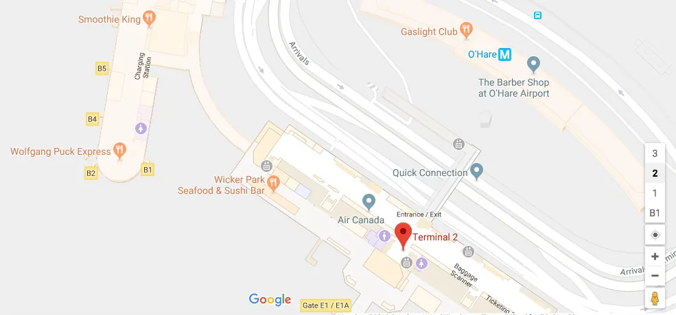
Using the Chicago O’Hare International airport as a leading example, I took note of elements being used within the indoor map renderings such as icons, colors, font-family, line strokes, and other elements that would provide a better sense of direction for the construction of indoor floor plans.

Design
Using The Franklin Institutes printed maps, along with an overview 2D map rendering of the museum building, I began to layer each floor layout on top of each other to find consistency in shape and form of the building itself. I used a combination of Adobe Illustrator and Adobe Photoshop to help me find a balanced alignment.
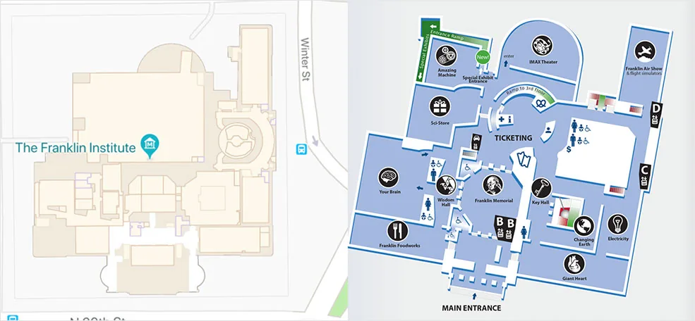
Once I had each floor plan in close alignment to the 2D building, I began to reconstruct the floor plan layouts into scalable vectorized objects (SVG). When I completed each floor layout, I began following the steps provided by Google to submit each floor plan.
Submission Process
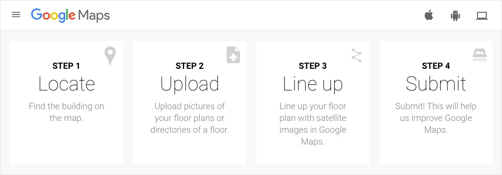
Google provided an easy to follow guide to get started with submitting the indoor floor plan. They included the following:
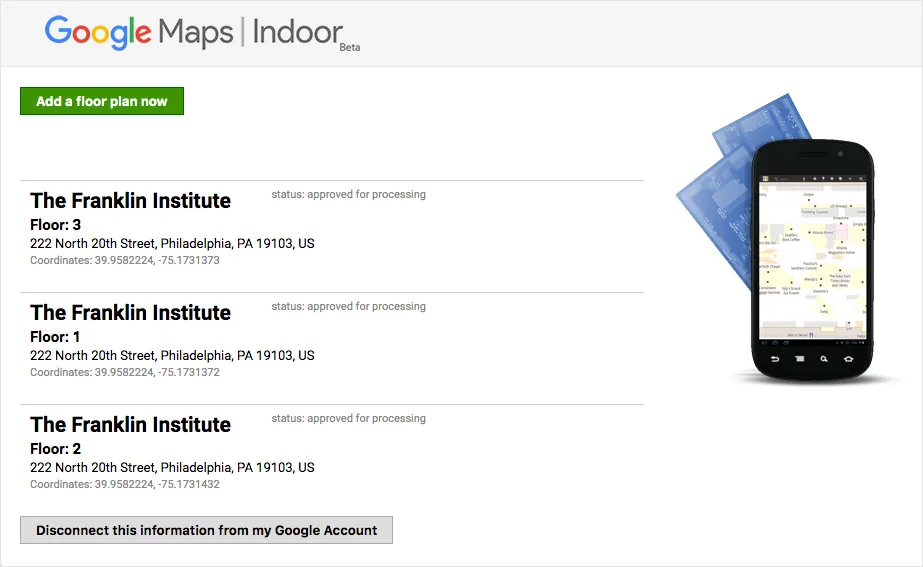
After submitting the floor layouts to Google Maps I received confirmation of their receipt. Google allowed me to log into the Indoor Maps portal using my Gmail account so that I could continue tracking the status of my submission. A few months later, I received notification the submission of the maps has been approved.
Final Indoor Map
To experience the entire building floor-by-floor, click "View larger map" in the top-left corner of the map. This will open the page in a new tab. Once on the map page (if using a desktop), click the building to expose the floor-picker tools. These tools should appear in the bottom-right corner of the map. If using a smartphone, click "View larger map" to launch the Google Maps application. Otherwise, launch Google Maps and begin to search for The Franklin Institute.
Outcome
Since the approval process took longer than expected, I decided to pivot mid-way through the project and leveraged Micello's Indoor Mapping API (HERE Technologies). After contacting a chief representative at Micello, I was granted permission to use their API free of charge for the duration of my capstone year. In return, I was to submit an SVG version of the museum floor plans I constructed for Google.
Along with the indoor map, I built a native mobile application using appMobi's XDK Emulator development kit. This technology allowed me to wrap HTML, CSS, and jQuery to be deployed as an Android native application build.